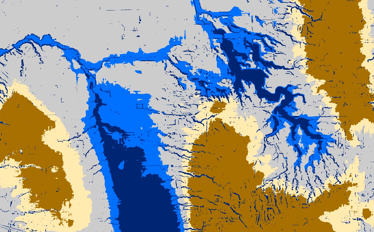
I’ve managed to pilot most of a fast high resolution landscape position workflow with PovRay as my magic tool. The final steps I hope to pipe through PostGIS Raster. In the meantime a screenshot and description: blues are riparian, raw ocre, etc upland categories, grey is mostly flat lake plain and mid slopes, all derived from just a high res DEM input (no hydro lines as input, so it works on areas where you don’t know where the streams may be). There will be more categories in the final, in the meantime, welcome to December.

One thought on “Landscape Position: Conclusion?”