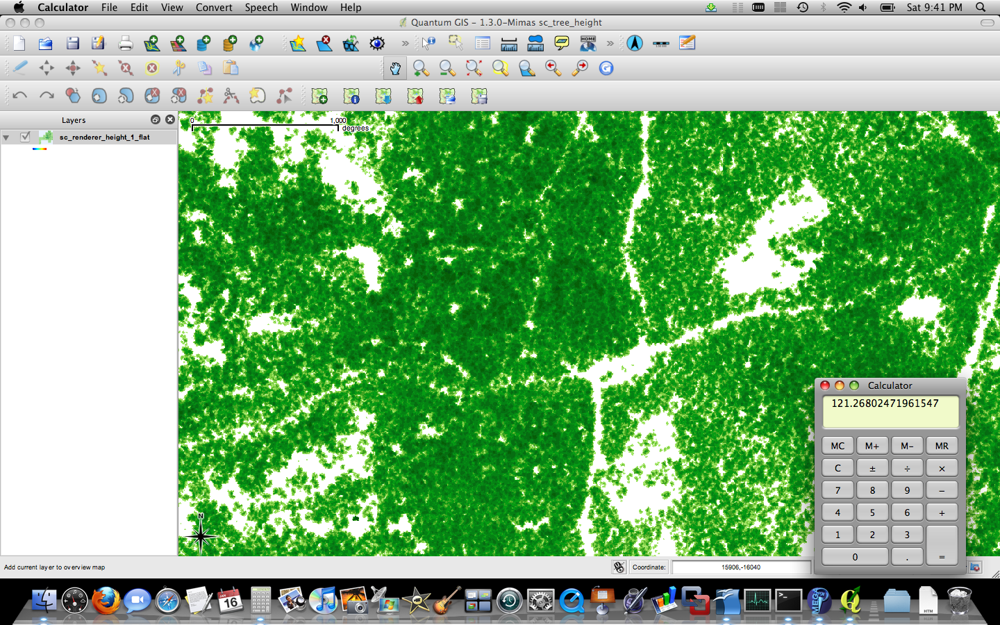
Just another shot of our digital surface model of the forest. This time, I rendered it with all of the trees at base elevation 0 (zero), placed the orthographic camera at height 150, so our 16-bit range we’re rendering to should scale 0-150 feet to 0-65535 values, giving us a precision of 0.002 feet. The original LiDAR data has a precision of 0.01 feet, so we’re not throwing data away with the integerization. By the way, we don’t have enough LiDAR points to really derive canopy shape– we’ve invented the detailed canopy shape by using a tree shaped interpolation technique (if we can quite liberally call it interpolation– I’d hate to see the actual function written out).
Anyway, the pretty pic– the darker the green, the taller the tree– we max out around 120 feet in most areas. We do find at least one 149 foot tall tree, but I’m guessing that’s on a steep slope, and is an over estimate due to a tree leaning of spreading over a cliff, or some such scenario. Of course, if it does exist, I should go look for it. I did measure one in the field last year that exceeded 130 feet, and I couldn’t spot the top, so it may have been much taller.

Oh, and Mac bragging rights here– I couldn’t render the full 30,000 x 30,000 pixel scene on Windows XP (although Vista may have handled it), but it rendered just fine in 35 minutes on my Mac laptop.
