
NCGIS was an excellent conference, and this year was my first attending / presenting. Bravo to the organizers, who themed it Mobile and Global, but confessed that Mobile, Global, Open would have been more apropos.
To catch screen captures and audio for the presentations, see this temporary location:
http://geodata.lib.ncsu.edu/pub/2015NCGIS_Pres/
which is organized by room numbers, so check out the schedule: http://ncgisconference.com/#schedule .
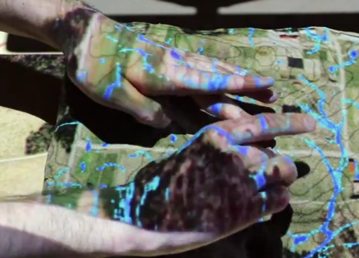
My favorite new ideas from the conference, aside from talks by Randale Hale, Howard Butler, and Paul Ramsey were local to NC State University, with Helena Mitasova from the Open Source Geospatial Research and Education Laboratory.
See especially their Tangible Landscape which ties a sandbox in to real-time GRASS DEM processing (flow accumulation, viewsheds, fire modeling, etc.):
http://geospatial.ncsu.edu/osgeorel/tangible-landscape.html

One thought on “North Carolina GIS Conference”