Ok. I confess, clickbait. OpenDroneMap won’t make the animated gifs for you. But come on! it can make the 3D models which you can view in Meshlab or where ever, and then create animated gifs. Ok ok. I promised animated gifs. These are from data contributed to our test dataset repo by Aaron Racicot and Tomasz Nycz respectively.


Nice but with what level of quality can you extract features from it?
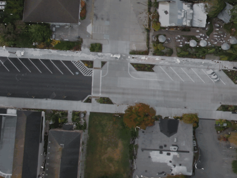
The texturing is full resolution from the input images, so depending on flight height and camera specifications, the resolution of the mesh and orthophotos can be quite high.
Love it!
Thanks!
Great work, from the picture at the top i see this is from the langley dataset, what parameters did you use to get this?
Good eye. ‘–resize-to 3000’ is the only parameter set, and I just made that the default, as it gives much better results in (almost) every test I have run.
got it, I was just running one with octreeDepth of 15 to see the results