Great news on OpenDroneMap. We now have a branch that has MVS-Texturing integrated, thanks to continuing work by Spotscale, and of course continuing integration work by @dakotabenjamin.
The MVS-Texturing branch isn’t fully tested yet, nor fully integrated, but the initial results are promising. MVS-Texturing itself handles the problems of choosing the best photos for a given facet on a textured model in order to do a great job texturing a complex scene. This bears the promise of vastly improved textured models and very nice orthophotos.. It seems an ideal drop in for the texturing limitations of OpenDroneMap. From the project site:
Our method addresses most challenges occurring in such reconstructions: the large number of input images, their drastically varying properties such as image scale, (out-of-focus) blur, exposure variation, and occluders (e.g., moving plants or pedestrians). Using the proposed technique, we are able to texture datasets that are several orders of magnitude larger and far more challenging than shown in related work.
When we apply this approach to one of our more difficult datasets, which was taken on a partially cloud part of the day…
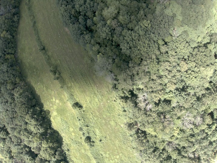
we get very promising results:


Hi
The OpenDroneMap project is really interesting. Is it possible to somehow integrate with QGIS? Getting the UI from QGIS and the power from ODM?