
Good news to report, though I haven’t finished my own testing yet… but OpenDroneMap, which previously would just create point clouds from drone images, now also produces:
- Meshes!
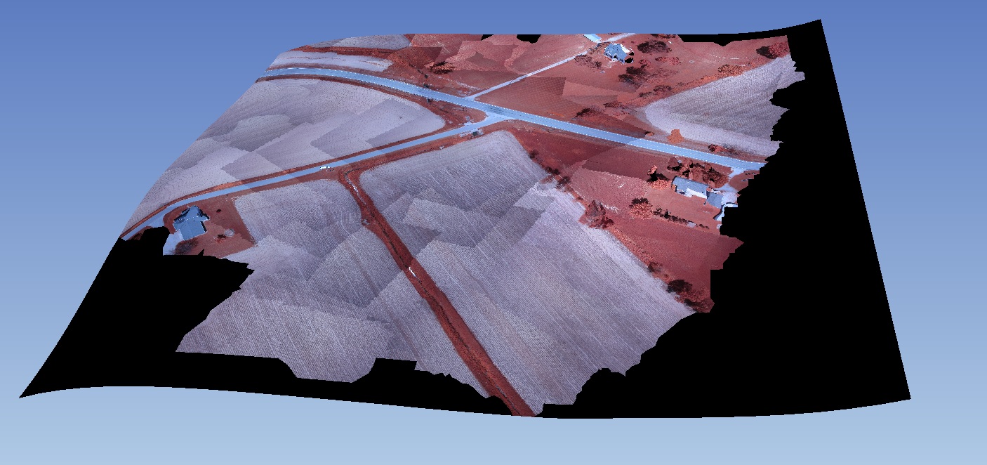
- Textured meshes!
- Georeferenced textured meshes (if the exif data has geographic coordinates)
- Georeferenced orthophotos! (if the exif data has geographic coordinates)
Now, I’d like those ifs to go away, but that requires a bit of thoughtful interface work. In the mean time, give it a whirl on your data.
Work left to do:
- Refine processing chain
- Allow for input of GCPs for images without GPS in their exif
- Blending / brightness correction, etc. of input images
- Digital surface model output
See this branch on github for the whole package : https://github.com/OpenDroneMap/OpenDroneMap. A special thanks to Spotscale (http://www.spotscale.com/) for undertaking and executing this work.
(Just integrated with the main branch January 20, 2015)
These are Spotscale’s screenshots. I’m re-running on my own test machine for validation as we speak (so to speak):


This looks excellent! What Linux distro do you use for the project?
Ubuntu is the distro of choice to date. I think it would work unmodified on Debian, but I don’t know that anyone has tried. So far it is just tested with 12.04 for texturing and orthophotos. I’ll be testing with 14.04 shortly.