No docs yet for orthophoto generation and the use of GCPs in OpenDroneMap, but for the early adopters, check out this branch of OpenDroneMap:
https://github.com/OpenDroneMap/OpenDroneMap/tree/ortho-gcp
The format of the GCP file is simple. The header line is a description of the coordinate system (nothing formal here). Subsequent lines are the X, Y & Z coordinate in your coordinate system, your associated pixel and line number in the image, and the image name itself:
WGS84 UTM 17N
306285.997948 4545379.373772 218.375076 755 1159 IMG_0541.jpg
306086.87645 4545305.068275 220.971863 1874 1508 IMG_0548.jpg
306286.079002 4545211.102966 222.374451 1650 2381 IMG_0605.jpg
306258.256744 4545357.435387 218.836639 1763 2603 IMG_0513.jpg
306323.770813 4545246.277000 222.837692 543 2326 IMG_0521.jpg
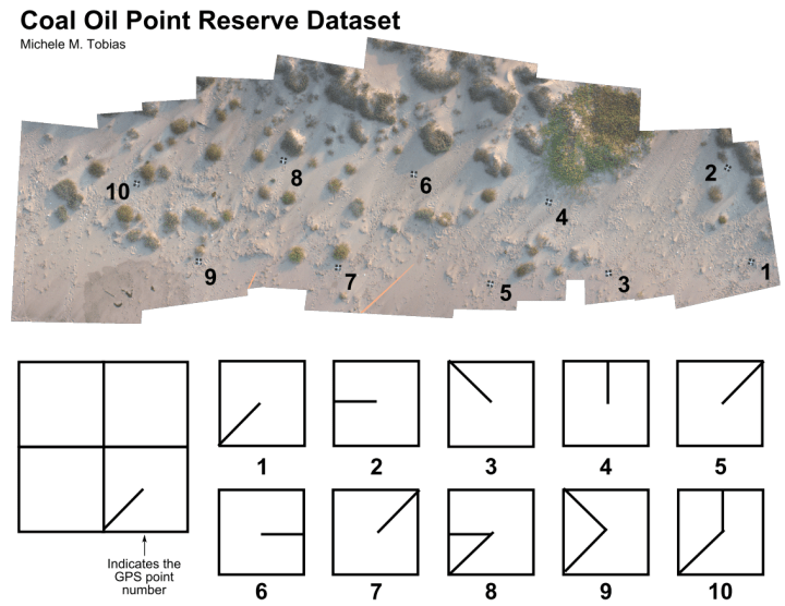
For your edification, the schematic of ground control for Michele M. Tobias & Alex Mandel’s Cole Oil Point Reserve dataset.

One thought on “OpenDroneMap — Orthophotos and GCPs”