This tweet: https://twitter.com/MapKnitter/status/604309664558354433
is the beginning of some fruitful discussion, I suspect. There are some really awesome projects gaining momentum. I’ll give an overview of them as best I am able.
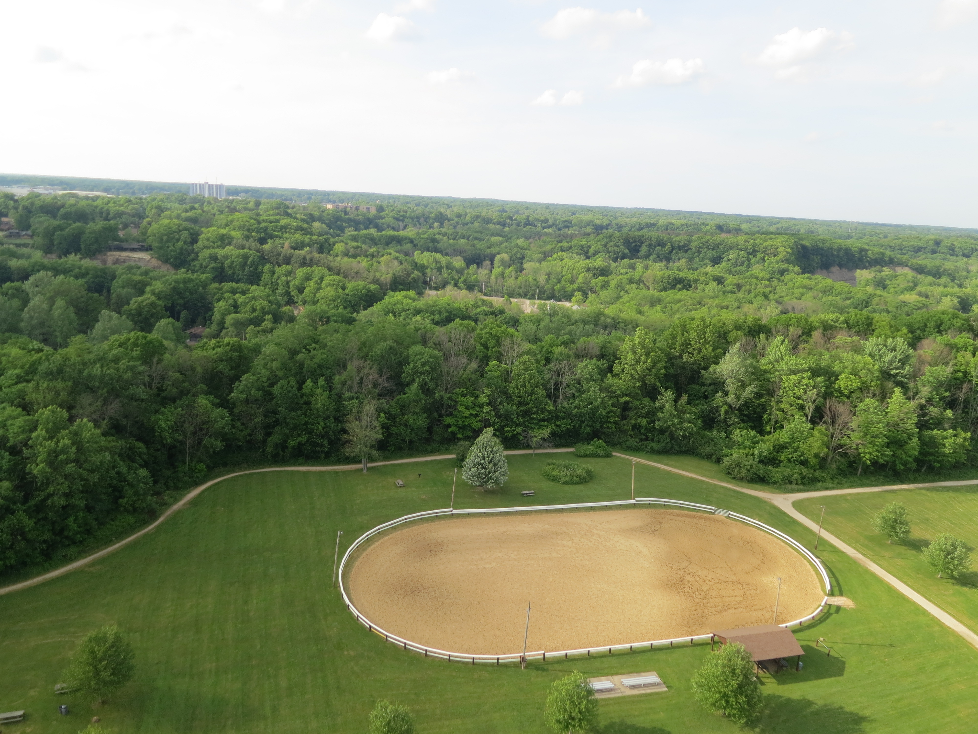
Let’s start with the one nearest and dearest to my heart (if you’ve been reading my blog, you can skip this part): OpenDroneMap. OpenDroneMap is an open source toolkit for processing drone, balloon, kite imagery into geographic data. It does this by using fully automated feature-matching between images, which create a 3D point cloud. From that, we can create a 3D surface (mesh), textured mesh, and orthophoto. This guy says it better:
But, it’s just a stand alone, Linux (Ubuntu)-based tool. It requires some geekiness to run, and it does not (at least not yet) act as a platform. By that I mean, generically, you can’t just upload images to it and get the wonderful output from a service, and we don’t have a place to store and share all this wonderful data that comes from and will be coming from drones and other aerial platforms. This is where (from my selfish perspective) the other projects are so well timed… .
Let’s start with OpenAerialMap. From the Development Seed blog post on it (yes, you should follow the link. Don’t worry, I’ll wait until you return):
OpenAerialMap is a set of tools for searching, sharing, and using open satellite and drone imagery. This initial release includes the core infrastructure to catalog petabytes of open imagery. It also includes an extremely usable API and an elegant web interface to submit, search and download available imagery.
This is a reboot of a couple of previous attempts at solving this problem space, and it’s really exciting to watch passionate and brilliant work take place to make this happen. Also, this is not an easy problem space, and is being really thoughtfully simplified and implemented.
(As a side note, I’m not going to get into the distinction between OpenAerialMap and OpenImageryNetwork — not today anyway)

Open Terrain is a project for which a portion of its scope is to do for terrain models what OpenAerialMap and OpenImageryNetwork will do for open aerial datasets. The projects are informing each other and growing together, which is awesome collaboration to observe.
Finally, Mapknitter has recently been rebooted too, and it’s now a really elegant tool for taking a few aerial images and knitting them into a usable map (ok, it always was p. cool — now it’s even more elegant). What’s great about MapKnitter is it specifically addresses the problem of georeferencing balloon, kite, or drone images in a simple-to-use interface in the browser.

So, back to the question:
https://twitter.com/MapKnitter/status/604309664558354433
Bravo, yes. Lets. I have been thinking about, talking to people, discerning the strengths, overlaps, and complementary fittings of these projects as they have emerged. We are headed toward some really great things… . More specific thoughts to come.

One thought on “OpenAerialMap, OpenImageryNetwork, MapKnitter, OpenTerrain, and OpenDroneMap”