Conservation and Research
A little while back, Charles Ritzler, a PhD student with Case Western Reserve University and employee of Cleveland Metroparks Zoo reached out to me. Charles works with Dr. Kristen Lukas, our Director of Conservation and Research, and as such, his work focuses on improving (quoting Dr. Lukas page) “scientific animal management” and “research on the behavior, health, and welfare” of vertebrate species in zoos. There is such great work happening in this space at Cleveland Metroparks Zoo, Zoo Atlanta, and elsewhere supporting inquisitive and applicable research on what makes animal welfare in zoos better, in addition to work internationally on conservation. Previous posts I’ve done on this blog regarding gorilla research in Rwanda have been as a result of work with Dr. Lukas.
Charles had 3 projects in mind: the first was to do a drone mapping flight over the new rhino enclosure in order to have a good map against which to plot rhino use of the space. The redesign of the enclosure is meant to improve rhino well being, but as with all these improvements, the effectiveness of this needs monitored and assessed over time. Zoo staff then make informed decisions about both future capital opportunities and smaller, incremental changes to improve animal welfare. These studies in general are a close collaboration between keeper staff and conservation research staff. The second project he proposed I can’t remember at the moment, but it was similarly an easy request to support. Then, he looked a little nervous as he prepared for the third request: He pulls out his laptop, and shows me a small photogrammetrically-derived model of a smaller exhibit he produced with a cell phone camera and Agisoft Photoscan, and he asks, tentatively: “Can we do this with the orangutan exhibit in order to track animal usage with the upcoming improvements to their enclosure? Maybe fly a drone in the enclosure?”
Anyone who knows me or reads my blog might already know that an enthusiastic response was coming in return: use drones and photogrammetry to improve animal welfare in a challenging environment? Heck yeah! Sign me up! And so we got started on a new project.
What do orangutans need?

Aside from the standard needs for living (food, light, space, etc.), orangutans are unusual as great apes are concerned. As much as chimps, gorillas, and humans are good at climbing trees, even enjoying and sometimes preferring it, orangs are the only truly arboreal great ape. Native to Malaysia and Indonesia, they don’t just like to climb: it’s fundamental to who they are and how they live.

As such, orang enclosures need to give plenty of vertical space in order to fascilitate the physical and mental health of their ginger inhabitants. Cleveland Metroparks Zoo has a nice concrete tree, fire hoses strung between points, and plenty of space to climb. The enclosure was under a geodesic dome built in the 90s, and didn’t meet modern standards: UV light is critical, and the panels blocked too much of it. Time for a new dome!
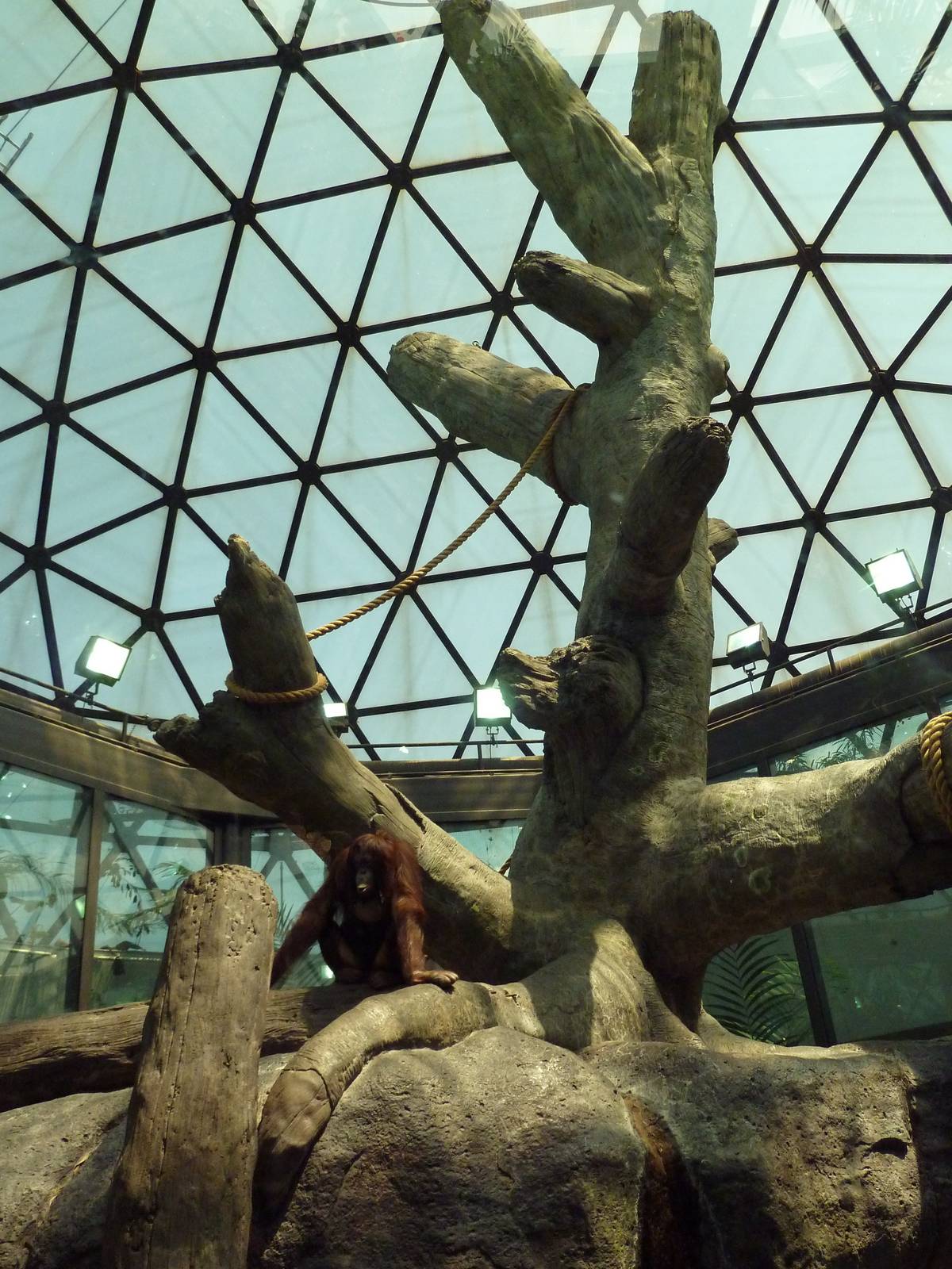
The opportunity with putting into place a new dome is that we can install more vertical space for the orangutans to play and live. In other words: improved spa days for the orangs: more climbing space and plenty of sunshine! Yay improved animal care!
The challenge
The challenge from an assessment perspective is how do we map, visualize, and monitor the usable space for the orangutans and how it changes? It’s a complex arboreal space, and with the new dome coming, has the potential to become more complicated.
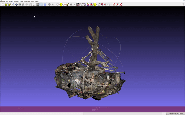
The answer is as Charles proposed: photogrammetry to the rescue. Lots of pictures from drone, camera, and a 360 camera. We did this once before the new dome and once after the dome and other improvements.


Results
So, how does the model look? Pretty spectacular, frankly. How does it function? Charles indicates he was able to get some really detailed measurements of the old exhibit design that detailed in unprecedented ways the available space for the orangutans. I’ll report back more after this latest round is completed.

One thought on “Mapping animal exhibits using OpenDroneMap: orangutan space estimation for the win.”